Introduction

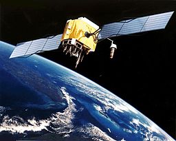
The Global Positioning System or GPS for short, formerly known as “Navstar GPS,” is a radio navigation system based on satellites. It transmits geolocation and time information to a GPS receiver anywhere on or near the Earth where four or more GPS satellites have an unobstructed line of sight. The GPS requires no data transmission from the user and operates independently of phone or internet signals.
The system was developed, is maintained, and is freely available to anyone with a GPS receiver. The system was initially restricted to military use in the United States, but civilian use was permitted in the 1980s.
Technological advancements and new demands on the system have prompted efforts to modernize the GPS. Other global or regional satellite navigation systems have been developed or are in the process of being established by a number of countries. GPS’s next generation is represented by the current GPS Block IIIA satellites and Next Generation Operational Control System (OCX).
Satellites of Block IIIA and the Next Generation Operational Control System (OCX). These changes were initiated by Vice President Al Gore and the Clinton Administration in 1998, and were authorized by the United States Congress in 2000.
The United States government degraded GPS quality in the 1990s through a program referred to as “Selective Availability,” which was ended on May 1, 2000 by a law signed by the then President Bill Clinton.
The GPS service is provided by the US government, which has the ability to selectively deny access to the system, as happened to the Indian military during the Kargil War in 1999, or to degrade the service at any time.
As a result, a number of countries have developed or are in the process of developing additional global or regional satellite navigation systems. The Russian Global Navigation Satellite System (GLONASS) was developed concurrently with GPS, but it had insufficient global coverage until the mid-2000s.
GLONASS can be added to GPS devices, increasing the number of available satellites and allowing positions to be fixed more quickly and accurately, to within two meters (6.6 ft). China’s BeiDou Navigation Satellite System began global operations in 2018 and will be fully operational by 2020.
The European Union’s Galileo positioning system and India’s NavIC are also available. The Quasi-Zenith Satellite System (QZSS) of Japan is a GPS satellite-based augmentation system designed to improve GPS accuracy in Asia-Oceania, with satellite navigation independent of GPS scheduled for 2023.
When selective availability was lifted in 2000, GPS had an accuracy of about five meters (16 feet). The most recent stage of accuracy enhancement employs the L5 band and is now fully operational. GPS receivers that use the L5 band and were released in 2018 can have much higher accuracy, pinpointing to within 30 centimeters (11.8 in).
History of GPS technology

In order to overcome the limitations of previous navigation systems, the GPS project was launched in the United States in 1973. The system, which originally used 24 satellites, was developed by the United States Department of Defense. It was initially designed for military use and became fully operational in 1995.
The design of GPS is based partly on similar ground-based radio-navigation systems, such as LORAN and the Decca Navigator, developed in the early 1940s. In 1955, Friedwardt Winterberg proposed a test of general relativity – detecting time slowing in a strong gravitational field using atomic clocks placed in orbit inside artificial satellites.
Use in consumer technology

(An image of a GPS receiver unit next to matchsticks to showcase how small it is, this is found in many consumer electronic devices)
While GPS was developed as a military project, it is now considered a dual-use technology, which means it has significant civilian applications as well.
GPS has become a widely used and useful tool in commerce, science, tracking, and surveillance. The precise time provided by GPS aids in everyday activities such as banking, mobile phone operations and even the control of power grids with synchronized hand-off switching.
Here are some other technologies/systems which leverage GPS technology:
- Online Maps: Systems like Google Maps, Bing Maps and other digital mapping solutions make use of GPS to faciliate navigation. This is also used by device vendors like TomTom and Navman.
- Sports: Used in football and rugby for training load control and analysis.
- Surveying: Absolute locations are used by surveyors to create maps and help to determine property boundaries.
- Clock syncing: GPS time signals have an accuracy of 10 ns, which is second only to the atomic clocks on which they are based and is used in applications such as GPS disciplined oscillators.
- Cellular telephony: The first handsets with built-in GPS appeared in the late 1990s. In 2002, the FCC mandated the feature in either the handset or the tower so that emergency services could locate 911 callers. Third-party software developers later gained access to GPS APIs from Nextel upon launch helping to faciliate many other features and functionality.
- Radio occultation: This technology is used for weather and atmospheric science applications.
Other entries from our technology glossary:
Conclusion
We hope you found this resource to be helpful if so be sure to share it and consider following agrtech on social media to keep up with new content we share.
Also check out our business solutions, online tools & software, blog and videos for more.
Citation(s):
(2001). Global Positioning System [Online]. Wikipedia. Available at: en.wikipedia.org/wiki/Global_Positioning_System (Accessed: 2 June 2021).
Simon Taylor, www.phooto.co.uk, CC BY-SA 2.5 <https://creativecommons.org/licenses/by-sa/2.5>, via Wikimedia Commons
NASA, Public domain, via Wikimedia Commons
![logo-new-23[1] logo-new-23[1]](https://agrtech.com.au/wp-content/uploads/elementor/thumbs/logo-new-231-qad2sqbr9f0wlvza81xod18hkirbk9apc0elfhpco4.png)